Garmin echoMAP™ CHIRP 72dv
Overview:
Fish with the Power of CHIRP
- 7-inch color display with keypad control
- Available with or without a transducer with high wide CHIRP, 250 W and Garmin CHIRP ClearVü™, 500 W
- Panoptix™ all-seeing sonar support (transducer not included)
- Includes worldwide basemap for general reference
- Preloaded Quickdraw Contours custom HD map creation software
It’s time you started fishing with the power of CHIRP sonar. The easy-to-install, easy-to-use 7-inch echoMAP CHIRP 72dv is available with or without a transducer for high wide CHIRP sonar and Garmin CHIRP ClearVü, the clearest scanning sonar on the water. It supports Panoptix and includes preloaded Quickdraw Contours software to instantly create your own HD maps with 1-foot contours as you fish. Internal 5 Hz GPS updates position and heading 5 times per second. It provides NMEA 2000® support for engine data, sensors, FUSION-LINK™ audio system, autopilots and more. Cords plug directly into the mount, allowing you to quickly install and remove your device from power and mount. Transom and trolling motor mounts included.
The Garmin CHIRP Difference
The built-in sonar capabilities of echoMAP 72dv include CHIRP sonar, the most sophisticated sonar technology available for the fishing and boating public. CHIRP sonar provides amazingly clear target separation and definition because it puts even more energy onto the target than traditional sonar. It also includes sonar-recording capability that coordinates the timing of the sonar return with your boat's position and saves digital information for playback on a computer using HomePort™ planning software. Use the user data sharing cable to share waypoints and routes between multiple devices.
Clear Scanning Sonar Images
Garmin ClearVü scanning sonar gives you a nearly photographic image of what passes below your boat. You clearly see structure, submerged objects and fish. Traditional Garmin HD-ID™ sonar and ClearVü scanning sonar are combined into 1 transducer. Also provides HD-ID support for Minn Kota® and MotorGuide® trolling motors with integrated transducers.
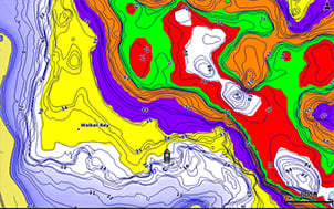
Create your own HD maps
Quickdraw Contours is a free, easy-to-use software feature already installed on your compatible Garmin combo. It instantly creates your own personalized HD fishing maps with 1-foot contours. Tailor them to fit your needs. They are your maps — you own them. Keep the data to yourself, or share it with the Quickdraw Community on Garmin Connect™. There’s no special surveying expertise required. You just fish while it creates maps. You don’t have to wait around or send your files away like other mapping software requires — your results appear instantly. Use with any of the following sonar transducers: Garmin Panoptix™, HD-ID™ traditional, CHIRP-enabled, Garmin ClearVü™ or NMEA 2000®-compatible depth. Have more than 1 sonar device installed onboard? Quickdraw Contours automatically selects the most capable sonar device to provide the very best results for you!
Heading and Position Refreshed 5 Times per Second
Fast, responsive 5 Hz GPS/GLONASS refreshes your position and heading 5 times each second to make your movement on the screen more fluid. Now it’s quick and easy to drop up to 5,000 accurate waypoints and find your way back to your secret fishing hot spots.
Add Panoptix LiveVü Forward Sonar
With LiveVü Forward your boat can be moving or stationary. Wherever your trolling motor is pointed, you will see live images of what is happening under the water. Watch your lure as it sinks, and see its depth and movement as you retrieve it. See it move in relationship to structures in the water. See fish swimming, reacting to your bait; if they attack, you’ll see and feel the hit. Once on the hook, watch the fight on your screen as it happens. With Panoptix LiveVü Forward, you can see it all come to life up to 100 feet away.
Upgrade with the Best Maps on the Water
A single microSD™ card slot provides expandable memory for accessory map purchases such as BlueChart® g2, BlueChart® g2 Vision®, LakeVü HD or LakeVü HD Ultra. LakeVü HD Ultra and BlueChart g2 Vision provide exclusive Garmin Auto Guidance, a technology that directs you to your hot spots. Based on your boat’s specifications, Auto Guidance instantly creates a visual path you can follow to avoid shallow water and other charted obstructions.
Take Your echoMAP with You
When you’re off the water, it’s easy to keep your echoMAP safe and secure. You don’t have to mess with plugging and unplugging wires from the unit because the cords plug directly into the mount. This allows you to quickly install and remove your echoMAP from power and the mount.
Enhanced Auto Guidance
Just enter the location where you want to go and patented Garmin Auto Guidance technology instantly searches through relevant charts to create a safe, virtual pathway on the display that helps you avoid low bridges, shallow water and other charted obstructions en route.
With enhanced Version 2.0, you have access to more features and capabilities. You’re able to adjust the calculated Auto Guidance pathway by inserting “via” points at interim stops or landmarks along your desired route. You can easily review hazard points along your calculated path. And you can even engage your compatible Garmin autopilot to follow the Auto Guidance route, automatically. Other 2.0 enhancements give you the ability to calculate arrival times at any point on your route (great for timing arrivals to correspond with bridge openings and other time-critical events). Better still, you can now save your plotted Auto Guidance paths for future navigation by backing them up on an SD™ card with your BlueChart g2 Vision or LakeVü HD Ultra cartography¹.
GPX Waypoints Transfer
If you have waypoints, tracks or frequently used routes stored on another manufacturer’s GPS product - or on a Garmin handheld device - now it’s easier than ever to transfer those items to your new Garmin chartplotter, via industry-standard GPX software formatting. GPX is an open standard format for GPS data exchange across platforms and applications. With this easy-to-use interface technology, Garmin has taken “no waypoint left behind” to a whole new level of trade-up convenience.
Multiple Depth Range Shading
Designate up to 10 different depth ranges each with its own color. Makes it easier to view target depths at a glance.
Commission Autopilot from Chartplotter
To make commissioning easier and more convenient, you can handle the entire autopilot commissioning process from your chartplotter screen.
FUSION-Link Entertainment System
Enjoy the ability to control all compatible FUSION-Link-enabled audio systems directly from your compatible chartplotter display.
Special Sailing Features
Supported SailAssist features include laylines, enhanced wind rose, heading and course-over-ground lines and true wind data fields. Gauge displays are designed to provide important, need-to-know information at a glance, including true and apparent wind angle, set and drift, true or apparent wind speed, horizontal graphs and a data bar with customizable data fields. To help you gain a wind-maximizing competitive edge, your chartplotter features a pre-race guidance page that shows your virtual starting line, along with data fields showing laylines, time to burn before the start and a race timer.
¹BlueChart g2 Vision or LakeVü HD Ultra SD card is required for this technology.
SPECIFICATIONS:
Physical & Performance |
|
| Physical dimensions | 9.8"x5.5"x2" (25cmx13.9cmx5.1cm) |
| Display size, WxH |
6.0"x3.6"; 7.0" diagonal (15.2 x 9.1 cm; 17.8cm diagonal) |
| Display resolution, WxH | 800 x 480 pixels |
| Display type | WVGA display |
| Weight | 1.7 lbs. (0.77kg) |
| Antenna | Internal or external over NMEA 2000 |
| NMEA 2000® compatible | YES |
| NMEA 0183 compatible | YES |
| Power consumption |
6.2W |
| Mounting options | Bail or flush |
| Garmin Marine Network™ ports |
1 Panoptix™ port |
Maps & Memory |
|
| Preloaded maps |
None |
| Accepts data cards |
1 microSD™ card |
| Waypoints |
5,000 |
| Routes | 100 |
| Track log | 50,000 points; 50 saved tracks |
Chartplotter Features |
|
| Garmin Sonar compatible |
Yes |
| Supports AIS (tracks target ships position) | YES |
| Supports DSC (displays position data from DSC-capable VHF radio) | YES |
| Tide tables | YES |
| BlueChart® Mobile (planning) compatible |
No |
| Garmin Helm compatible |
No |
Sonar Features & Specifications |
|
| Dual-frequency (50/200 kHz) sonar capable | YES |
| Dual-beam (77/200 kHz) sonar capable | YES |
| Frequencies supported |
CHIRP (low, mid, high) Traditional: 50/77/200 kHz ClearVü: 260/455/800 kHz |
| Transmit power | 500 W (RMS) / 4,000 W (peak to peak) |
| CHIRP sonar technology | Yes (Built-in) |
| ClearVü |
Yes with CHIRP (built-in) |
| SideVü |
No |
| Maximum depth |
2,300 ft @ 77 kHz, freshwater 1,100 ft @ 77 kHz, saltwater (depth capacity is dependent on water bottom type and other water conditions) |
| Bottom lock (shows return from the bottom up) | YES |
| Water temperature log and graph | YES |
| Sonar recording | YES |
| Sonar history rewind | YES |
Connections |
|
| Transducer pin numbers | 8 |
| NMEA 0183 input ports |
1 |
| NMEA 0183 output ports |
1 |
| Video input ports |
None |
| Video output ports |
None |
| Wireless connectivity |
No |
IN THE BOX:
Transducer Version
- echoMAP CHIRP 72dv with worldwide basemap
- Power/data cable
- Tilt mount
- Quick-release cradle
- Protective cover
- Flush mount kit
- GT20-TM transducer (8-pin)
- Transom mount
- Hardware
- Documentation
Without Transducer Version
- echoMAP CHIRP 72dv with worldwide basemap
- Power/data cable
- Tilt mount
- Quick-release cradle
- Protective cover
- Flush Mount Kit
- Hardware
- Documentation
Current Reviews: 0
This product was added to our catalog on Monday 23 January, 2017.

